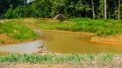
Troy Lambert, environmental analyst with the City of Sioux Falls, South Dakota, discusses how MS4s can use drones in their programming. Lambert touches on how drones can make imaging more accessible and shares how they can be used to identify outfalls conveying discharges other than stormwater. To conclude, Lambert touches on challenges of using drones, such as drones being geolocked out of some areas by the Federal Aviation Administration (FAA) or weather limitations.
To view the entire Stormwater Solutions video library, click here.